Say you want to canoe down the Au Sable River in northern Michigan for a few days and hang with the deer, eagles and smallmouth bass. The local Chamber of Commerce will stuff your rucksack with dozens of brochures for campgrounds where you can stab a wienie and sleep under the stars.
Now try that on the Grand, Michigan’s longest river. The deer, eagles and bass will be there — and so will the sheriff, because you’ll be trespassing.
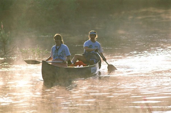
That’s just one of the unnatural imbalances the organizers and paddlers of the 2010 Grand River Expedition hope to change.
It took special permission from a dozen jurisdictions to accommodate the 187 paddlers registered for an epic 13-day haul from the Grand’s headwaters, near Liberty, south of Jackson, through Jackson, Lansing and Grand Rapids to the river’s mouth at Grand Haven.
Part sport, part science, part media circus, the expedition is meant to shine a light on mid-Michigan’s under-appreciated main stem, as its predecessors did in 1990 and 2000.
The expedition is scheduled to put in at the Center Lake dam in Jackson at 7 a.m. today, camp at Eaton Rapids Friday night and arrive at north Lansing’s Brenke Fish Ladder Sunday for a massive public display of river love.
Camping isn’t everybody’s bag, but the dearth of public or private campsites on the 260-mile Grand (there’s only one, where the Rogue meets the river’s main stem) is one of those surface snags that connects to an underlying peril: The people of westcentral Michigan don’t protect and appreciate their own river in proportion to its size, beauty and importance.
“A lot of people have never paddled through their town,” 2010 Expedition rivermaster Charlie Parmalee said. “They don’t know where the river goes.”
Parmalee has spent hundreds of days (and nights, but let that pass, officer) exploring the Grand.
“I could take you places where you’d swear you were on the Au Sable,” Parmalee said. “But when I tell people I paddle the Grand, people say ‘ugh,’ like it’s a sewer. At one time, it was, but they’ve done a lot to clean it up and they’re doing more all time. The river gets a bad rap.”
Caps off
When the 2010 Expedition paddles through downtown Jackson today, they’ll see the first dramatic sign that the river is changing for the better.
The 1990 and 2000 expeditions ran into several portages, most of them dams. But in downtown Jackson, they encountered one of the most depressing crossings this side of the Styx: a 2,000-foot stretch of the river that was diverted into a culvert and capped with concrete in 1937. Much of the cap was a parking lot, but it wasn’t a case of paving paradise.
“They covered it up because of the smell,” Parmalee said. “That tells you what they used it for.”
Since 1978, six children have been trapped under the cap and drowned.
In the wake of the 1990 expedition, a Jackson-area group called GREAT (Grand River Environmental Action Council), pushed to get rid of it.
Parmalee thinks the 2000 expedition also played a role.
“We wanted to stop in Jackson and have a ceremony, and that ended up inspiring them to remove the cap,” Parmalee said. “You can paddle through there now.”
The stretch was “daylighted” and cleaned up by December 2000 and is now graced by a riverwalk, where people will cheer the 2010 expedition downriver.
The Jackson cap is an extreme case of river blindness, but there are more widespread and significant signs that the Grand River is rebounding. Scott Hanshue is a fisheries biologist for the state’s Department of Natural Resources and Environment, or DNRE, assigned to the Grand River watershed, Hillsdale to Grand Haven. He’s studied the Grand for almost 20 years.
Hanshue is writing the Grand River Assessment, a report on the overall condition and potential of the river.
Next week, he’ll oversee one of the expedition’s more dramatic events, a "boom shocking" fish study on a mile-long stretch of the Grand between Grand Haven and Portland.
What is boom shocking? A boat with a generator drops two anodes into the water and stuns the surrounding fish. They are gathered in nets by the hundreds, identified by species and measured in various ways. (Dorsal spines, for example, tell a fish’s age.)
The boom shocking is part of a statewide fish study timed to coincide with the expedition — “But not too closely,” Hanshue said. Members of the expedition and the general public are encouraged to watch, if they keep their members out of the water. Hanshue said “99.9 percent” of the fish recover from the shock.
Hanshue said water quality in the 1970s in the Grand was so bad that the dominant species tolerated degraded water quality (common carp and white sucker). More sensitive fish (red horse sucker, smallmouth bass, northern pike) were largely absent. Fish species found in various Grand River spots numbered in the low teens.
More recently, the MDNRE’s boom shockers have found more than 30 species.
Go to the Sixth Street Dam in downtown Grand Rapids, Hanshue said, and you’ll find a “significant recreational fishery” with salmon, steelhead and even warm water species like walleye, bass and channel catfish.
Clubs and spears
Gloria Miller has lived all of her 85 years in the same house on a centennial farm near the Looking Glass River in Wacousta, six miles west of DeWitt.
Miller paddled the length of the Grand with the 1990 and 2000 expeditions, the last time to celebrate her 75th birthday. This year, she plans to finish the trek a third time and muscle her Verlen Kruger Sea Wind canoe into Lake Michigan on her 85th.
“Some places on the Grand River, you’d think you were out in the wilderness,” she said.
When Miller and the expedition went through Grand Rapids in 1990, after a heavy rain, the city was only beginning its sanitary/storm sewer separation project. “There were things floating in the river that we were suspicious of, and there was an unpleasant odor.”
By 2009, Grand Rapids has cut its combined sewer overflow rate 99 percent, according to city statistics.
“Things have changed,” Miller said. “People are more aware of the watershed.”
Miller has seen the river through a lot of ups and downs. The Looking Glass, an important tributary of the Grand, was a crucial source of food for her family during the Great Depression. Many winters during the 1930s, she and other kids were sent upstream with wooden “pounders” and beat on the ice to drive the fish downstream. (The river froze because of a nearby dam, now removed.) The men waited upstream with spears.
“They’d lay down on the ice, chop a hole, and drop navy beans onthe river bottom,” she said. The white beans showed where the bottomwas. When a dark oval eclipsed a bean — fish! Down went the spear.
Fishing and swimming were carefree then, but so was dumping.
“Wejust took the river for granted,” she said. “As a kid growing up, youeither buried trash in the back 40 or dumped stuff in the river.”
Municipalities and industries took the same attitude for decades.
Inthe late 1970s and 1980s, an array of plating facilities tied to theautomotive industry spewed toxic heavy metals and oxygen-depletingwaste into the Grand, Hanshue said. Slaughterhouses and wastewatertreatment plants did the same. Swimming advisories were common for the Grand and its tributaries in the 1970s.
“There were a lot of pollutants,” Miller said. “Typhoid was even in there.”
Millersaid her stretch of the river changed noticeably when a new $11 millionwaste-water treatment plant in DeWitt went online in 1980.
“The river, through Clean Water Act implementation, has rebounded dramatically,” Hanshue said.
Federallymandated point source controls on discharges account for much of therebound. The rest goes to sewer separation projects that are far alongin Grand Rapids, Lansing and Jackson.
Combinedsewage overflows are still a problem — more than 1 billion gallons ofsewage went into the Grand as recently as 2005. But most observersagree that the next big challenge to the river comes from non-pointpollution, or fertilizer runoff from lawns and farms.
Notonly is the Grand one of the most urbanized rivers in the state withbig cities like Lansing, Grand Rapids and Jackson, but also one of thestate’s most intensive agricultural areas.
“Youstill have a tremendous amount of phosphorus entering the system fromtributaries throughout the 660-squaremile watershed, which is about 60percent agriculture,” Hanshue said. There’s about a mile of tributaryfor each square mile of drainage.
“All that runoff is in the main stem [of the Grand] and Lake Michigan,” Hanshue said.
Other contaminants, such as mercury or PCBs, simply come down in rain or atmospheric dust, from as far away as Chicago.
“We still have a way to go,” Parmalee said.
Watershed moments
The first GrandRiver Expedition in 1990 was the brainchild of grizzled Lansing legendVerlen Kruger of Delta Township, the world’s most traveled canoeist,who died in 2004 at 82. (On Monday the expeditionwill camp in the shadow of a statue of Kruger next to the river in Portland.)
GeologistJim Woodruff, 88, who still lives on the Grand in Delta Township, wasanother key planner. Doug Carter, chairman of the 2010 Expedition,helped organize the 1990 trip while working at the old Department ofNatural Resources.
Cartersaid this year’s trip was “extremely challenging” to fund. GeneralMotors contributed $75,000 to the 1990 and 2000 trips, but passed thepaddle this time. Parmalee said the 2010 expedition relies “90 percent”on regional fundraising, paddler fees and freebies from sponsors andhost communities along the river corridor providing food, campsites,water and portable toilets.
But the expedition has proved to be much more than a once-a-decade joyride.
Ifa watershed is knit by a network of rivers, each Grand River Expeditionhas expanded and strengthened a mirror network of river supporters.
“The camaraderie was great,” Miller said. “I got acquainted with lots of people, people I’m still friends with.”
“After 13 days together on the river, you’re like family,” Parmalee said.
Inthe wake of the 1990 expedition, Miller and other paddlers formed theFriends of the Looking Glass River, one of the most active riverguardian groups in the region. Miller is still president. Another majortributary of the Grand, the Thornapple, got its “friends” group at thesame time, as did the Red Cedar and Maple.
Suchgroups, according to the DNRE’s Steve Sutton, are crucial to the wellbeing of the state’s rivers. Sutton made no bones about the agency’scapacity to stay on top of a sprawling watershed like the Grand. “We’rein transition,” he said. “Everybody’s just kind of hunkered down tosurvive.”
Sutton,who runs the Natural Rivers program for DNRE, is the agency’s point manwith the 2010 Expedition. About 35 DNRE staffers will either paddlealong or give talks at stops along the way.
He marveled at the 187 participants registeredfor the 2010 Expedition. “That’s as big as our entire division,” hesaid. “Our agency relies on partners like that. We need those eyes andears out there.”
Afterthe 2000 Expedition, two new watershed groups came together: the UpperGrand River Watershed Assembly and Lower Grand River Organization ofWatersheds, or LGROW.
That leaves a big hole in the doughnut: the central Grand River watershed, Lansing’s section.
Carteris retired from a 30-year career with Michigan’s DNR, and served aschief of Rivers, Lakes and Streams. He is also an extension educator atMichigan State University in water quality and watershed issues.
He expressed surprise that the home of state government and MSU, a major research institution, should lag behind the river keepers upstream and downstream.
Aprime goal of the 2010 Expedition is to fill that hole and start anonprofit watershed group dedicated to the middle Grand, he said.
Ifthat happens, the next step is to connect all three Grand Riverwatershed groups into a network to better share information, actionalerts and lobby for policy action. Rivers don’t acknowledge borders,so why should their guardians?
Bugs
TheGrand River expeditions have been golden networking and advocacyopportunities, public relations bonanzas for the river and great funfor participants, but they haven’t been as rigorous as planned from thescientific point of view.
The1990 Expedition started with a strong research component. Carterrecalled that MSU’s Institute of Water Research and Grand Valley StateUniversity were involved.
“Theydid quite a bit of new research on the river,” Carter said. “I’membarrassed to say we were unable to locate the results of thatresearch.”
“A lot of the information from 2000 got scattered,” Parmalee said. “We’re still looking for some of that water-testing stuff.”
Parmaleedrew a picture of well-meaning volunteers, many of them seniors withoutcomputers, gradually losing track of scattered files during the 10-yearintervals between expeditions.
He promised it wouldn’t happen this time.
Alongwith all of the 2010 results, any data recovered from 1990 and 2000will also be put online. “The word is out there, and we’re looking forit,” Parmalee said. “We’re going to take everything we have and make itavailable to the public.”
ButCarter said that even if the data are recovered, the expedition can’tafford to do the kind of research that would stand up to peer review.
“Alot of that work, including chemical analysis, requires laboratoryanalysis and professional staff,” he said. “We have no money to doanything like that. Research is one of those things that had to go bythe wayside.”
Instead,Carter said, the expedition will try to capture a snapshot of the waterquality and environmental quality “through a number of means,essentially non-scientific.” These include macroinvertebrate sampling(“bugs,” Carter said) and an army of eyeballs scoping out the bankerosion, land use and vegetation along the way. New data on waterquality would be “a bonus,” Carter said.
“Thewhole idea behind this is not so much scientific analysis, but get thepublic turned on to the fact that a river runs through their backyard,”he said.
It’s toolate to turn on and sign up for the whole expedition, but latter-dayvoyagers are invited to join for a day paddle. (See the Web address inthe box accompanying this story.)
Topaddle the stretch from Eaton Rapids to Lansing Saturday, arrive at 6a.m. — yes, 6 a.m. — with $10 (to cover insurance) and a canoe or kayak.
The Eaton Rapids-to-Lansing stretch is not a pristine wilderness experience, but it’s an eye-opener all the same.
“There’smore wilderness than you think,” Parmalee said. “There’s high banks, alittle floodplain. It’s cut some new channels, but it’s pretty much thesame river the Indians used.”
Parmalee is philosophical about the intermittent garbage, poor development decisions and industrial grunge.
“People need to see the ugly parts and beautiful parts,” he said.
Revertingto classic agency lingo, the DNRE’s Hanshue urged people to “get outand utilize the resource.” He quickly switched to the English: “Peoplehave got to realize that it isn’t such a nasty river anymore.”
2010 Grand River Expedition
Day paddlers welcome. For itinerary go to
www.michigan.sierraclub.org/issues/greatlakes/GRE_participant_info.html


Support City Pulse - Donate Today!
Comments
No comments on this item Please log in to comment by clicking here