

FRIDAY, May 17 — After an outcry from one of Lansing’s more economically challenged neighborhoods, Mayor Andy Schor is looking to reverse plans to bill hundreds of homeowners for an upcoming environmental study.
That funding — about $180,000 — is now set to be covered, although less directly, by every taxpayer in the city.
Dozens of local residents voiced concerns to the City Council Monday after they’d received notices to pay thousands of dollars amid efforts to recalculate the size of the Red Cedar River floodplain. Officials predict the floodplain to shrink, allowing some homeowners to escape the designation.
Flood insurance rates are skyrocketing. City officials said anything the city can do to ease the burden — and produce a more accurate map of the actual Red Cedar floodplain — could be worth the added assessment on local residents. Those bills, however, have since disappeared after public pushback and some mayoral budget tinkering.
But that doesn’t mean they won’t be paid.
Instead, Schor directed proceeds from the recent sale of a city-owned parking ramp — cash that would have otherwise gone toward a citywide effort to digitize thousands of paper documents — to cover the costs of the entire study. The allocation heads to the City Council Monday. Schor expects the move to erase neighborhood concerns.
“This project is important because it’ll reduce the number of properties in the floodplain,” Schor said. “We know that insurance and paying this assessment can be a challenge for some folks living in those neighborhoods along the Red Cedar. We’re not going to take that from them. We didn’t need to use taxpayer dollars here.”
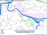
The initial proposal — the subject of Monday’s public hearing— sought to bill the owners of 529 homes, 63 commercial parcels and six apartment buildings based on square footage, partner with other municipalities, contract with the federal government and re-calibrate maps of the city’s Red Cedar floodplain.
The existing maps, while not totally flawed, are based on the results of outdated technology from the ‘80s, city officials explained.
A $360,000 contract with the federal government’s U.S. Geological Survey enables the revisions, of which less than 20% was initially to be paid by the city. The bulk was to be funded through the assessments and other local municipalities including Ingham County, East Lansing and Meridian Township. The federal government, Michigan State University and the Lansing Board of Water & Light have also pitched in.
The mayor’s recent budget shift pushed the initiative — and two-thirds of its total costs — back onto the city’s shoulders. And while residents won’t be billed directly for the study, the project is still set to be funded through city coffers using money that could have otherwise been spent on other projects that benefit tax-paying residents.
“The mayor knew this was a huge issue for me,” said 1st Ward Councilwoman Jody Washington, who represents those in the floodplain. “It was the poorest of the poor who were being hit with this assessment in my ward. It would’ve been terrible. It would’ve been cost prohibitive for them. I’m thankful the mayor actually dug into the budget and found that money.”
Added Council President Carol Wood: “We absolutely heard what the community was saying and fixed this.”
“I’m not in favor of another assessment,” said Councilwoman Patricia Spitzley. “I think we’ve assessed our residents to death. Even for the commercial businesses properties over there, it’s not those are multi-million dollar companies. These are small businesses and families — many who cannot afford this at all.”
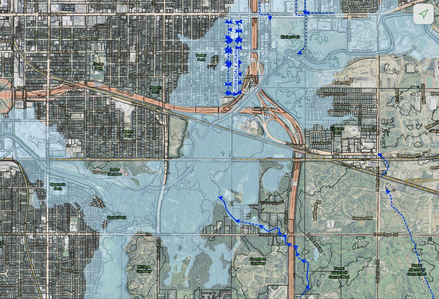
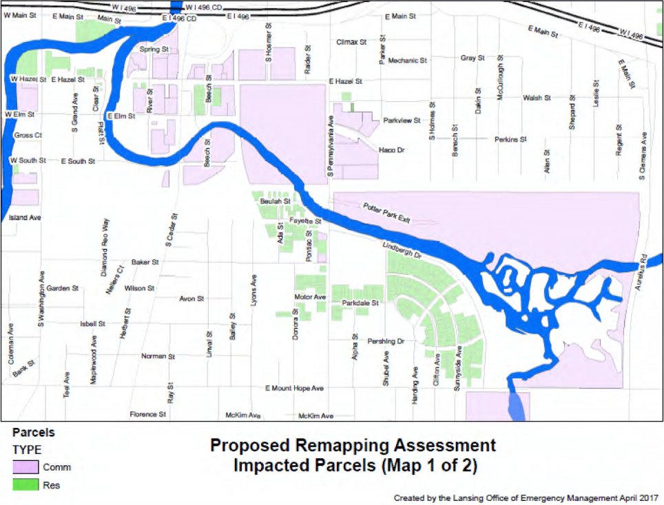
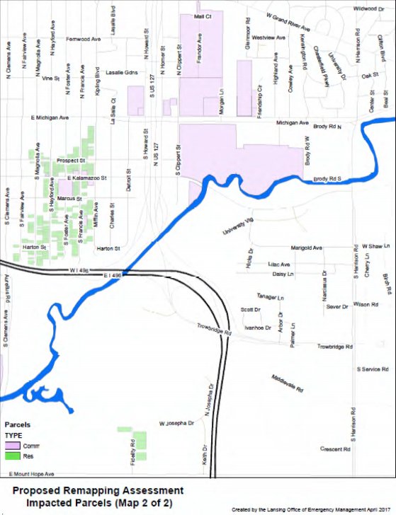
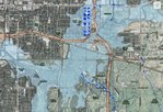
The mapping project will study the Red Cedar River floodplain to the east side of Meridian Township. That area in Lansing includes more than a thousand parcels, but only 570 property owners adjacent to the riverside were initially to be assessed for the costs, said Ronda Oberlin at the city’s Office of Emergency Management.
That assessment had primarily focused on a block of homes north of I-496 and south of Michigan Avenue between S. Clemens and Mifflin avenues.
Another neighborhood on the western side of Sycamore Park received assessment notices as well.
Of those 570 property owners, about 222 are required under federal law to carry flood insurance as a term of their mortgage. Only 162 actually maintain a policy, with an average cost of about $1,100 annually, Oberlin said. And officials predict those ever-climbing rates to rise as high as $4,400 annually over the next 10 to 15 years.
“The goal has always been to reduce flood insurance premiums for these property owners,” Oberlin said. “Flood insurance used to be affordable. Over the years, that just hasn’t been the case. And now it could mean the difference between someone keeping their home and losing it altogether. This benefits those residents.”
Lansing’s nearly $240,000 total contribution to the Red Cedar remapping project now equates to about $1,500 paid for every insurance-carrying homeowner that was originally set to be billed.
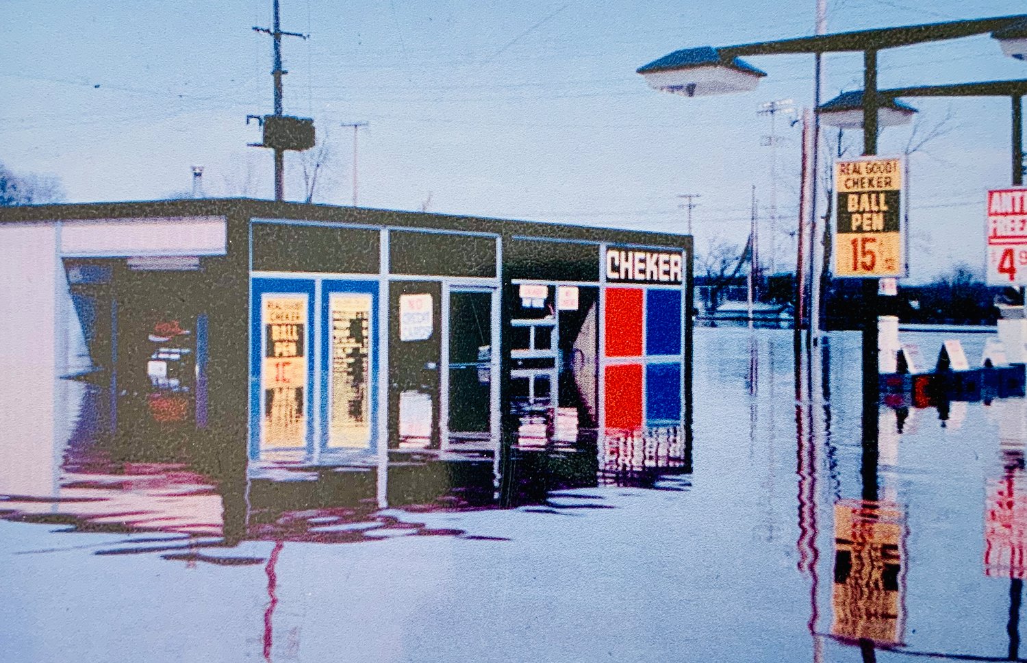
Oberlin predicts the study would nudge 60 to 150 properties out of the floodplain as currently mapped and allow them to dodge rising insurance premiums. But residents — especially after their neighborhoods were flooded in 2018 — were hesitant to fork over any more money just because they live within the city’s floodplain.
Beech Street Resident Jesse Anguiano said his home was among many that faced flood damage in recent years. Residents in his neighborhood were initially set to be billed an average of $88 for the two-phase assessment.
“It’s becoming normal for this city’s bureaucratic process to cause confusion and anxiety in this neighborhood,” Anguiano said. “There are some low-income couples and retirees who just don’t have the money to pay to help offset these costs. Even if it was only $70 or $80, that’s a lot of money for some of these people to pay for this.”
The mapping project will recalculate points along the river to better determine the probability of a severe flooding event. It could also continue east of Meridian Township, Oberlin said, but that would be depend on the differential between the original, flawed maps and the results of the upcoming study.
Ingham County Drain Commissioner Pat Lindemann suggested a more comprehensive study on the Red Cedar River will be needed regardless of the ongoing plans. He also said the costs should be shouldered equally by every municipality situated along the 35-mile riverbank.
“To make our rivers healthy and productive, you need to understand how they work in their totality. This map is just going to become outdated shortly after it’s completed,” Lindemann said. “Rivers are nothing more than mirror images of land use. We need a comprehensive watershed plan more than just this snapshot of the river.”
The new funding for the project — that was originally set to be billed to local residents — comes from the sale of the city’s Townsend Parking ramp to the state of Michigan earlier this year. About $12 million of the $18 million purchase repaid outstanding debt with the remainder spread by the mayor across various city initiatives.
A half-million-dollar line item from the sale to shift city administration to paperless documents has since been removed to cover the Red Cedar study. About $300,000 in the remaining surplus revenue will instead head toward sidewalk repairs, Schor said. And some City Council members expect the change to push through without a hitch.
“That half-million dollars to go to paperless? That’s without any type of study or realization of future costs,” Spitzley added. “Protecting and supporting our citizens is a higher priority, for me, than to go paperless this year. I’m not saying we shouldn’t do it eventually, but I’m not going to vote this onto the backs of our residents.”
Visit lansingcitypulse.com for continued coverage as the discussions continue next week.


1 comment on this item Please log in to comment by clicking here
Support City Pulse - Donate Today!
CharlesH
The FEMA Flood Map Service Center seems to have a more up to date map. The area around the Red Cedar/Sycamore Creek says it was updated in 2011 Link: https://msc.fema.gov/portal/home
Friday, May 17, 2019 Report this